Saturday, January 21, 2017

The Beauty of Vancouver Island by Katherine Pym

Pacific Inlet on  Vancouver Island, BC, Canada
I've visited the BC area of Canada a few times. As an American who lives in the Seattle area, you'd think we'd pile in the car and visit several times a year but life got too often in the way.

We have friends who live in Port Alice, located at the bottom of a deep inlet on Vancouver Island. The map shows it only a finger width away, but in actuality it took two solid days to get there.

Vancouver Island ripped from mainland
If you look at Vancouver Island on the map, it's slightly askew, ranging from Southeast to Northwest with an archipelago of San Juan Islands scattered between it and the mainland. The border of Canada and the US slices through the San Juans. Vancouver Island is near the Cascadia Subduction zone and must have ripped off the mainland during a massive, plate tectonic earthquake (my theory anyway).

We had to take a ferry and even though it's quite a thrill to travel that way, it is time consuming, what with the lines and the wait. We landed at Sidney BC (a wonderful place with so many bookstores-heaven!), went through customs and kicked the petal to the metal.

We headed north, and more north and even more north than that. As you get into the wilderness, there are fewer roads. You can't cross from one side of the island to the next due to a mountain range that seems to march up the center of the island. Lakes abound. Pacific inlets cut deeply through the landscape. Wildlife peeks at you from the fence strung along the road.


Sea Otter
Once we reached Port Hardy, which is as about as far as you can go in a car, we headed back south again. Black bears crossed in front of us. Eagles perched on the high branches of trees.

We meandered on a narrow road with twists and turns, crossing the island toward the Pacific Ocean. Fur trees towered overhead. Every once and awhile, lakes would shimmer beyond the pine fronds and thick trunks. At nightfall we reached Port Alice, a tiny town nestled between the inlet and the mountainous foothills.

Bald Eagle
It was almost dark when we pulled into the drive.  Our friends and dogs bustled out of the house and helped us with our bags. 'We'll go fishing, tomorrow,' Nick said. 'You'll love it,' Sue added.

The next day dawned calm and breathless, the inlet glassy. You could hear sounds travel from miles away. It was beautiful, breathtaking. We clamored onto the boat and motored the length of the inlet to open sea.


  ~*~*~*~*~*~    

Coming July 2017

The story of Sir David & Lady Kirke of Ferryland, Newfoundland, a saga of sorts that begins with David and his brothers conquering Québec, and ending with Sara as North America's foremost female entrepreneur.

Thursday, January 19, 2017

Avalon

The Province of Newfoundland is Canada’s newest province and it is also home to the oldest settlement in Canada - Avalon.


PILLARS OF AVALON
Canadian Historical Brides (Newfoundland) 
by Katherine Pym, researcher Jude Pittman

Excerpt 1
Avalon as seen through the eyes of Sir David Kirke in 1629

“A dark smudge lay on the water under heavy clouds. As the sails filled and their ship gained speed, the spot grew larger, more pronounced. Icebergs floated north of them. A whale careened out of the water, its fins like arms straight out, then hit the surface with a mighty splash. David laughed, for he considered this a message from Lady Fate. Great things awaited him on this land.

Small, outer islands protected the mainland. Heavy mist clung to the cliffs, swallowed coves and inlets that lined the shore. Last year they’d provisioned at a fishing camp higher up the coast called St. John’s but as they sailed along, David noticed a better established colony. The barren, desolate land with few trees reminded him of the highlands in Scotland, which was a cold, unforgiving place.
Buildings hugged the coast, with a mansion on the lee of a grassy hill. Smoke rose from chimneys into the mist and low lying clouds.

‘’Tis a beginning town much like those in our West Country,’ Dawson remarked.

‘Aye, ‘tis very pretty,’ David thoughtfully answered, for he could smell opportunity. Fishing boats crowded along the grand banks. All he needed do was stretch out his hand and coins would fill his palm.

This plantation must have been sanctioned by their king. He recognized a fishery works, which would be a good business. He’d fill his ships with wine, goods and trade them for salted fish, sell them to merchants in Portugal and Spain.

‘We will go there,’ he pointed and Dawson nodded. ‘Seems there’s a protected harbour.’

As they sailed between a large island and a peninsula, the winds calmed. By the time they followed the long length of land and found themselves in a large pool, the waters were clear as a lake. The bells from fishing boats, and a tall ship dinged lazily.

People emerged from their dwellings of stone and from a longhouse built next to the water. They carried swords, cutlasses, Wheelocks and cudgels.

‘Drop anchor,’ Dawson ordered.

‘I’m going ashore to see what this place is about.’ David turned to see the other ships dropping their anchors. ‘Send messages to my brothers and bring about a pinnace.’

‘Not sure it’s a good idea, sir,’ Dawson calmly said as he gazed at the throng on shore.

David grinned. ‘It’ll be fine and dandy, Dawson. Don’t fret. If there’s trouble, burn the place to the ground. After all, we’ve the letter of marque stamped with His Majesty’s broad seal, which allows us free rein to do as we please.’

He grabbed the rope and lowered himself to the pinnace, almost stationary in the smooth as looking glass water. He gazed up at his first mate’s worried face and laughed.

As David and his brothers neared the dock, several men greeted them with scowls and threatening gestures. ‘Art thou filthy French pirates come to harass our good town?’ one asked and he shook his cudgel.

The pinnace bumped onto the pilings and a seaman jumped out to secure rope to a cleat. David climbed onto the stone wharf. ‘No French pirates, here. We are of God’s good England and we come in peace.’ He would not crouch and stood tall, even as those he walked up to looked menacing.
Shoulders relaxed. A disturbance rattled the group and people parted as an older gentleman stepped up to him. David was aware of his brothers climbing out of the boat and onto the wharf. With them beside him, nothing could go wrong.

The gentleman extended his hand. ‘George Calvert, Lord Baltimore, here. I welcome you to Avalon Province.’


Excerpt 2
Seen through the eyes of Sir David Kirke’s wife Sarah in 1632 as they approach the shores of Avalon 

At dawn the next morning, amidst what seemed hundreds of fishing ships and shallops along the grand banks, gulls screaming overhead, the Gervase left the fleet and rounded a spit of land. They meandered through a cluster of small islands and entered suddenly quiet water.

Fishing boats anchored nearby. People worked within and without the stone buildings that clutched the shore. Small rowing boats bobbed at the pilings.

‘We’re in the Pool,’ David said with a smile. As they glided toward a buoy, he breathed deeply. ‘All of this is the Province of Avalon. That there is Lord Baltimore’s mansion. Last time I was here, his lordship was in the process of vacating it.’ He wrapped his arm around Sarah’s shoulders.

Her gaze swept the grassy land toward the grey skies where sea birds soared in the wind currents. The house stood on the lee of a hill, a sprawling two-storied structure built of stone, the roof a combination of thatch and flags. Beyond the house rose grassy hills.

A cold, damp wind soughed off the Pool and up the barren hill. The ship’s bell clanged. The deck creaked. Chains and cables squealed as the sails furled.

The land was barren but had its own beauty. It made her think of the books she’d read on Northern Scotland, a brash, wild country by what they and others who’d been there said of it.  There were few trees, here, except those planted about the headland.


Newfoundland and Labrador has a long and colourful history. In fact, there isn't a rock, cliff, tree or cave around here without a legend attached. 


Early Aboriginal Cultures

The rich and complex human history of this province can be traced to about 9,000 years ago when the first groups of a marine-oriented people moved into southeastern Labrador. By around 8,000 years ago the culture of those first groups had developed into what is now called the Maritime Archaic Indians. Around 7,500 years ago they buried a child in what is the oldest known funeral mound in North America. Around 5,500 years ago their descendants moved into Newfoundland. In the 1960s a Maritime Archaic cemetery was discovered in Port au Choix during excavations for a cinema. The cemetery is now a National Historic Site with a nearby Interpretation Centre which interprets the various pre-contact cultures of that area.

About 4,000 years ago, a separate and distinct culture arrived in northern Labrador. These arctic-adapted people we now call Paleoeskimos spread to the Island of Newfoundland where they lived until around 1,000 years ago.

Some 3,600 years ago a new culture shows up in the Labrador archaeological record. They are known as the Intermediate Indians. These people moved into central Labrador, and shortly after that the Maritime Archaic tradition vanishes from the archaeological record. It is not clear how or if the Intermediate Indians were related to the Maritime Archaic tradition.

Then, about 2,000 years ago, the ancestors of the Innu and the Beothuk are recognized in the archaeological record of Labrador and the island. These Recent Indians were more land-adapted than some of the earlier groups.

The most recent aboriginal group to arrive was the Thule people who migrated across the northern part of the continent from the Bering Strait to Labrador about 1,000 years ago. The descendants of the Thule are today’s Inuit.


The First European Visitors to North America

The oldest known European contact was made here a few thousand years later when Leif Eriksson and his crew of Vikings landed on the Northern Peninsula in 1000 AD. Although they didn't settle permanently, they left their mark on this part of the world at L'Anse aux Meadows – now a National Historic Site and UNESCO World Heritage Site – where you can explore an ancient Viking landing site and recreated sod huts.

Fast forward hundreds of years to 1497, when Italian-born Giovanni Caboto – more commonly known as John Cabot – dropped anchor in Bonavista and "discovered" the New World.


Arrival of Portuguese, Spanish, French, and English migratory fishermen

In the sixteenth century, Basque whalers established the first industrial station in the New World at Red Bay in Labrador to process whale oil. The site was chosen because whales migrated – and still do today – through the Strait of Belle Isle. In June 2013, this mythical place was named a UNESCO World Heritage Site, one of three such designations in Newfoundland and Labrador.

During the 16th and 17th centuries, fishermen from France, Spain, Portugal, Ireland, and eventually England arrived to feed on the fish of Newfoundland and Labrador. Most of the early permanent settlers came from southwest England and southeast Ireland, with the majority emigrating between 1750 and 1850 prior to the Great Irish Famine.

Although Newfoundland was England's oldest overseas colony, France played an important part in helping shape our history. French explorer, Jacques Cartier, arrived in 1534 and eventually the French established a colony in Placentia in 1662. By then, tiny settlements popped up around Placentia Bay, the islands of St. Pierre and Miquelon – still a colony of France today – and beyond the Burin Peninsula into Fortune and Hermitage Bays. During the 17th century, Newfoundland was more French than it was English. Oddly enough, by the middle of the next century, French settlement had disappeared mostly due to military success elsewhere in North America.


Canada's Youngest Province

Before 1949, Newfoundland had a history as a British colony, Britain’s "Grand Cod Fishery of the Universe", eventually becoming equal to Canada, Australia, and New Zealand as a full Dominion of the British Empire. Newfoundland and Labrador joined Canada on 31 March 1949 and the next day, the leader of the Confederation campaigns, Joseph R. Smallwood, became the new province’s first Premier.

Today, even though we're the youngest province in Canada, we're considered one of the fastest growing in the country with booming oil and gas, mineral exploration, and marine and IT industries. On the cultural side, St. John's is brimming with musicians, artists, writers, dancers, and craftspeople from the province, throughout Canada, and around the world – and all are drawn to Canada's eastern edge by our inspiring natural beauty. In fact, it's been said the city has the highest concentration of artists per capita in Canada.

Wednesday, January 18, 2017

Beautiful Towns and Cities

Each of these places is the focus of an article on Places To See In Your Lifetime.  Links are provided below the pictures if you want to read about them.

BANFF AVENUE


Learn more ...


PETIT CHAMPLAIN


Learn more ...


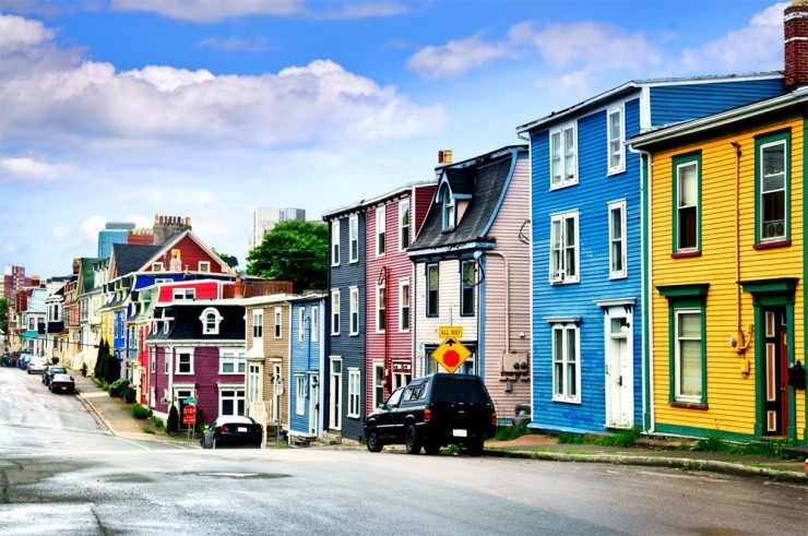
ST JOHN'S


Learn more ...


Tuesday, January 17, 2017

The Wilds of Canada, from British Columbia to Nova Scotia via New Brunswick.


When I was eight years old my family drove north from California and entered the wilds of Canada. British Columbia came first, and I was amazed at the lush beauty of the country. So much greenery, bright blue lakes, and tall, elegant pines. The wooden totem poles with their carved, scary faces, and the fact I had to wear a sweater in August. 

We took a huge ferry over to Vancouver Island and visited a botanical garden. A mock-up of Ann Hathaway’s thatched-roof cottage was there. My mother said she was Shakespeare’s wife. I don’t remember if I knew who he was at the time, but I vowed to see the original cottage in England when I grew up—and I have.

We dallied so long on the island, that we missed the ferry and had to stay the night. My father wasn’t happy because the inn was expensive, but my brother and I thought it a great adventure. The hotel we stayed in resembled an old English castle, with dark paneled walls and suits of armor lining the front hall.

Back on shore we traveled through Alberta and Saskatchewan, visited Banff and the magnificent Banff hotel. Even at the age of eight, that place impressed me. But British Columbia will forever have a place in my heart.

My next foray into Canada was many years later when I attended a writers’ workshop in Liverpool, Nova Scotia. We visited a nearby lighthouse where we climbed up into the wooden dome and watched a recording of a man who’d grown up in the lighthouse.

My husband and I drove around the island and looked at other lighthouses, one a bright red, watching out on a windy, pristine shore. We saw an ancient rampart in Halifax.
We visited pretty wooden villages, ate lunch at Indian Falls in Lunenburg and had the best haddock ever. To get to Nova Scotia, we drove the entire length of New Brunswick. The main road cuts a swath through towering pines, a wilderness I wish we’d had more time to explore, but we were late for the workshop.

This coming May I plan a trip to Saint John, New Brunswick where I’ll delve into its history in depth, watch the famous tides that can drop forty feet in the Bay of Fundy, and stand on the knoll of Fort Howe—unfortunately this fortress no longer exists—where some of my upcoming story on the settlement of New Brunswick takes place.

Coming in February 2018
 
 
To discover more about me and my books, please visit my BWL Author Page:
And my website:

Friday, January 13, 2017

The Beauty of Canada by Kathy Fischer-Brown


Salmon Beach, Chaleur Bay
Twenty days after setting sail from Saint-Malo in Normandy in April of 1534, Jacques Cartier reported: “The fairest land that may possibly be seen full of goodly meadows and trees.” His small fleet had just arrived for the first time on  the coast of New Brunswick. He named the bay where his ships moored “Chaleur” (now Chaleur Bay), which means “warmth” in French because of the heat they encountered in May of that year. His first impression of the interior of Canada was not so favorable: “The land should not be called New Land, being composed of stones and horrible rugged rocks…. I did not see one cartload of earth and yet I landed in many places… there is nothing but moss and short, stunted shrub. I am rather inclined to believe that this is the land God gave to Cain.” Cartier obviously was no naturalist; nor did he have an appreciation for the untamed beauty that greeted him. His mind was fixed on discovering a western route to China.


View from Mount Royal
In 1535, Cartier made a second voyage across the Atlantic to New France, ever hopeful of finding riches for his sovereign. Instead, he was greeted along the St. Lawrence by natives of Iroquois-Huron extraction at Stadacona, now Quebec City. From here he was determined to sail farther west upriver to Hochelaga, an Iroquois town of over 1,000 people living in bark longhouses surrounded by palisaded fortifications. By then, autumn had settled over this wild country, coloring the leaves in bright hues that astonished these French seafarers, who remarked they were “the finest trees in the world.”


From there they continued their journey west in long boats up the St. Lawrence, ever hopeful of finding that elusive Northwest Passage. Thirteen days later they came upon open fields in the shadow of a great mountain. “On reaching the summit,” he wrote, “we had a view of the land for more than thirty leagues round about. Towards the north there is a range of mountains running east and west. And another range to the south.” Cartier named this summit Mount Royal, today’s Montreal. Again, no mention of the colors of fall against an azure sky, or the sheer thrill of viewing nature in an unspoiled state.


Countryside in Quebec Province
Four hundred-and-thirty-some-odd years later, during my childhood and a few times while in my teens and early 20s, I visited a few of these same places in Canada on vacation excursions—mostly with my family to visit historical sites and landmarks—and later with friends. Even though the weather was cold and drizzly that spring in 1964, our trip to Quebec was remarkable. With its narrow cobbled streets, ancient brick buildings in the characteristic New France architecture, and the magnificent Chateau Frontenac of late 19th century vintage rising above the Old City walls, I experienced a sensation of having been taken back in time. I remember during the drive through the countryside that the land around the area was rustic, with miles of open farmland and everything just beginning its transformation from winter to spring. Set against the gray dippy sky, the scene resembled a water color painting.


View of Ottawa
Montreal’s Plains of Abraham were memorable—if not a bit soggy in the rain—as were the restaurants and shops and trying to speak French with the wait staff. The sun finally came out during our jaunt to Ottawa, where we toured the imposing Parliament with its gothic revival style and posed for pictures with the Mounted Police on duty there. (That was an extra-special treat for me, as I’d been a long-time fan of the TV show, “Sergeant Preston of the Yukon” since I was a kid in the mid- to late 1950s.) 


On another trip, we ventured to New Brunswick, where to our amazement, the Saint John River magically reversed its course as the Bay of Fundy’s changing tides exerted a power I’d never seen before or since. 


Montreal a second time had its charms in wintertime, especially the underground shopping and dining, which I experienced anew during a romantic weekend getaway prior to an enormous blizzard that closed down the Northway just hours after our harrowing escape return to upstate New York. Unfortunately, we did not get to see the city blanketed in snow, but that is all well and good, since I’ve never been a fan of cold and snow anywhere.


A visit to Toronto in 1971 with a friend, whose parents had relocated there from Connecticut, was also memorable. The nightlife was spectacular, especially for us young ’uns. Although not exactly a natural beauty, the city’s subways—the trains and stations—which we utilized to get around, impressed me with their bright white tiles and exceptional cleanliness


Street scene in Old Quebec
Beauty is many things to many people. While I greatly appreciate and admire the natural beauty of lakes, rivers, and mountains, of foliage in spring and autumn, sunsets and moonrises, fireflies on a warm summer evening, I take special pleasure in the monuments built and left behind by rugged pioneers and settlers—their homes and places of worship, their struggles to survive and thrive. My travels in Canada have left me with lasting memories and a few faded photos. It is my hope to return again soon.


~*~


Kathy Fischer Brown is a BWL author of historical novels, Winter Fire, Lord Esterleigh's Daughter, Courting the Devil, The Partisan's Wife, and The Return of Tachlanad, her latest release, an epic fantasy adventure for young adult and adult readers. Check out her The Books We Love Author page or visit her website. All of Kathy’s books are available in e-book and in paperback from Amazon.
 

Wednesday, January 11, 2017

The Yukon by Joan Donaldson-Yarmey


To celebrate Canada’s 150th birthday Books We Love Ltd is publishing twelve historical novels, one for each of the ten provinces, one for the Yukon Territory, and one combining the Northwest Territories and Nunavut. We Canadian authors were asked to pick one of the provinces or territories to write about or to do the research on for a non-Canadian author. I chose the Yukon because I have been there twice and love the beauty and history of the territory. The following is a quick summary of the Yukon.

 
The Yukon
The name Yukon is derived from the Loucheux first nations word Yukunah which means `big river'. The land was mainly occupied by the Tagish and Tlingit native people for centuries before the non-native explorers arrived in the 1820s. In the 1840s fur traders set up a few Hudson's Bay Company posts along the Yukon River. When the United States purchased Alaska from Russia in 1867, there wasn’t a clear border between Alaska and the Northwest Territories, as the land was known then. In 1887-88 William Ogilvie, a Canadian surveyor, surveyed the area making the 141st meridian the western boundary with Alaska and the 60th parallel the southern border with British Columbia. Hence the phrase North of 60.
     Prospectors went north looking for gold in the 1880s and there was a gold strike along the Fortymile River, which drains into the Yukon River, in 1886. There were other smaller strikes until 1896 when gold was discovered on Rabbit Creek later renamed Bonanza Creek. A town named Dawson sprang up on the Yukon River at the mouth of the Klondike River. When word of the gold discovery reached the outside world in the summer of 1897, thousands of men, women and children hurried to Dawson during the winter of 1897-1898 hoping to find their fortune.
     Because of the rush Dawson grew quickly to be the largest city north of San Francisco and it became known as the `Paris of the North'. It had hotels, dance halls, daily newspapers and saloons for its 30,000 inhabitants. Fresh eggs were brought by raft on the Yukon River; whiskey came in by the boatload before freeze-up; gambling made rich men out of some and paupers out of others; dance hall girls charged $5 dollars in gold for each minute they danced with a miner; the janitors made up to $50 dollars a night when they panned out the sawdust from the barroom floors. Due to the influx of people, the region officially entered into the confederation of Canada and was designated as the Yukon Territory on June 13, 1898. Dawson became the capital. Eventually the word `territory' was dropped and it was called The Yukon.
     A Territorial Administration Building was constructed in 1901 for the territorial seat of government and Dawson was the centre for the government administration until 1953 when the capital was moved to Whitehorse.
     The Klondike gold rush ended in 1899 when word of a gold discovery in Nome, Alaska, reached the prospectors and they headed further north. However, over the next few decades gold companies were formed and continued to mine the creeks, this time using dredges to dig up the creek bottom. They left behind huge piles of gravel called tailings. The dredging lasted until 1960 when gold prices declined making the operation uneconomical. Today, mining is done with big trucks, huge sluices, and back hoes.
     The north is known as the Land of the Midnight Sun after the words in Robert W. Service’s poem The Cremation of Sam McGee:
                    There are strange things done in the midnight sun
                      By the men who moil  for gold

 
The Arctic Circle is the most northerly of the five major circles of latitude of the Earth. It is an imaginary line that marks the southern edge of the Arctic at 66 degrees 30' north latitude in the Yukon and Northwest Territories of Canada, and in Alaska, Scandinavia and Russia. The land north of the Arctic Circle gets 24 hours of sunlight on the longest day of the year, June 21st. The further north of the circle you go the more days of total sunlight in the summer you will get. This is because the North Pole is tilted towards the sun and gets direct sunlight from March 20 to September 22 as the earth rotates. Conversely, on the shortest day, December 21st, the land north of the Arctic Circle gets 24 hours of darkness because the North Pole is tilted away from the sun.
     The Yukon is a great place to view the aurora borealis or northern lights. These are bright dancing lights that are really collisions between the gaseous particles of the Earth’s atmosphere and the electrically charged particles from the sun that enter the earth’s atmosphere. The most common colours are pink and pale green produced by oxygen molecules about sixty miles above the earth.  Silver, blue, green, yellow and violet also appear in the display. Red auroras are rare and produced at high altitudes of about 200 miles. The lights are best seen in the winter and the further north you are the better they appear.
     The Yukon has the smallest desert in the world, the Carcross Desert, near the town of Carcross. It is an area that was once covered by a glacial lake. As the glaciers melted the level of the lake lowered until just the sandy bottom was left. Winds off Lake Bennett keep the sand moving and prevent most plants and trees from taking root on this.
     During the late Wisconsin ice age (10,000 to 70,000 years ago) an arid section of the northern hemisphere was not glaciated because of the lack of moisture to support the expansion of the glaciers. The area, called Beringia after the Bering Strait which is near the centre of the region, encompassed parts of present-day eastern Siberia, Alaska, The Yukon, and ended at the Mackenzie River in the Northwest Territories. The growth of continental glaciers sucked up moisture which led to the sea level dropping by up to 106 metres (350 feet). As a result, a land bridge was formed between northwest North America and northeast Asia.
     It is believed that parts of western Beringia (eastern Siberia today) were occupied by man 35,000 years ago. The forming of the Bering Land Bridge allowed the first humans to travel from Asia to North America. There is evidence that the history of man in North America goes back 25,000 years ago.
     Some of the animals that survived for thousands of years in this arid land surrounded by glaciers were the North American horse and camel, the steppe bison, the giant beaver that weighed up to 181 kilograms (400 pounds), the Mastodon, the woolly mammoth, the giant short-faced bear, the scimitar cat, the American lion, and the giant ground sloth. All of these are extinct.
     The territory of The Yukon was founded on gold mining, but there has been coal and silver mining in the territory also. It is now a favourite destination for tourists.
 

Tuesday, January 10, 2017

Abraham Lake


It may look like blue pancakes, trapped under a sheet of ice, but it's not.  Those are methane bubbles and part of what draws photographers and nature overs alike to visit a man-made lake in Alberta.


The Huffington Post, Alberta says that "It may be man-made but it flaunts the same myrtle green in the water and the same mountain peaks around the lake that other natural, liquid wonders that dot the Canadian Rockies landscape provide. [...] In the bluish tinge of the winter's ice, photographs capture puffy pedestals of gas, cotton-like bubbles frozen in time and milky stains that colour the frozen surface.  [...] The features and colour showcased in all their glories in the ice are truly a sight to behold, but they are also to be respected, as they are nothing less than explosive.  What lurks beneath the surface of this bewitching lake is methane gas.  Methane is an effective fuel, burning - and exploding - with ease."


Want to know more?  Check out the Smithsonian's article.